


Can You Actually Predict Water Visibility? (And Why Ours Works Differently)

Every diver has lived this: you check the forecast, load the truck at 4 a.m., drive to the coast, gear up — and drop into pea soup. So the obvious question is whether visibility can be predicted at all, or whether we're all just guessing with extra steps.
The honest answer is: partly. And the partly is the whole story.
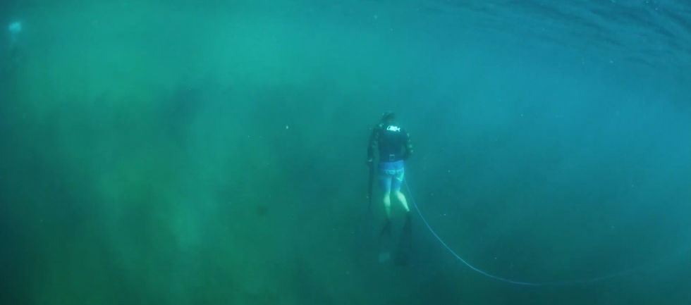
How much of that green you can actually see through is the whole question.
Why viz is predictable at all
Water clarity comes down to how much junk is floating in front of your mask. That junk is basically two things: sediment stirred up off the bottom, and plankton and algae growing in the water column.
Sediment is the good news. It gets kicked up by forces we can forecast pretty well — swell pounding the shallows, wind chop, runoff after rain, and upwelling dragging cold, murky water up from the deep. When a big swell hits a sandy bottom, viz tanks. That cause-and-effect is real and repeatable. A model fed decent swell, wind, and rain data can call the direction with reasonable confidence: “this weekend's going to be rough.”
Why it's so hard to nail exactly
Here's the bad news, and it's why so many forecasts miss.
Plankton is a wildcard. Blooms are biological, not mechanical. You can get a flat, calm, sunny week — perfect on paper — and a bloom greens the whole water column out of nowhere. No swell model on earth sees that coming.
Local quirks dominate. Viz is intensely local. A silty bottom takes days to settle; coarse sand clears in hours. A river mouth two coves over can wreck one spot and leave the next one gin-clear. The tide direction at your specific cove can matter more than the regional forecast. A prediction that's dead-on at one entry can be flat wrong 300 yards down the beach.
So the ceiling on this whole problem is: you can predict the trend and the odds fairly well, but the exact number — “20 feet on Saturday” — is chaotic. It's a lot more like a pollen forecast than a tide chart. Tides are pure physics and nearly perfect. Visibility has a living, biological wildcard baked in.
What this looks like on one real weekend
Picture a typical La Jolla setup. The regional forecast says small swell and light wind — a green light on paper. But it's a long-period south swell, the tide is dropping hard through the morning, and it drizzled two days earlier.
At an exposed, sand-bottom cove, that combination stirs the shallows and smears a plume of murk along the beach: 3-foot viz, blown out. A few hundred yards north, a sheltered rocky cove — same swell, same tide — sits at 15 to 20 feet, because its bottom doesn't hand off sediment the same way. One number for “La Jolla” would be wrong for both.
The regional forecast wasn't lying — it just can't resolve what the coastline does at that scale. That's the gap local knowledge fills. We break down each of these forces in our ranked guide to what actually drives visibility, and the way clarity changes with depth gets its own treatment in hunting the vertical inversion.
Where most tools go wrong
A wave of new apps promise clean visibility numbers at thousands of sites worldwide, powered by satellites and AI. The ambition is great, and some of the science is sound. But two things trip them up.
First, precision they can't back up. Handing you “18 ft” for a specific reef implies a confidence the underlying problem doesn't support. Even the best of them admit the accuracy still has to be proven in the real world.
Second, global scale kills local nuance. A model trained to work everywhere on Earth, by definition, doesn't deeply know your break — the exact way your cove responds to a south swell, or which tide turns it on.
How we do it differently
We took the opposite approach, and it comes down to three choices.
We go narrow, not wide. We'd rather understand a handful of local spots deeply than 28,000 sites shallowly. Local behavior is where the signal actually lives.
We give you odds, not false certainty. The winnable game isn't pretending to know the exact number. It's an honest, well-calibrated probability — “good conditions are likely” versus “don't bother.” That framing matches how the ocean actually behaves.
We check ourselves against the water. This is the part most tools quietly skip: we log what actually shows up against what was predicted, and we let real-world results correct the model over time. Ground truth beats a confident guess every day of the week.
We're not going to lay out the recipe here — the specific mix is what makes it work. But the philosophy isn't a secret: stay local, be honest about uncertainty, and let the ocean grade your homework.
A quick glossary
A few terms that come up whenever divers talk clarity:
Upwelling. Wind pushes surface water offshore and cold, nutrient-rich water rises from the deep to replace it. It's often green and murky — great for the food chain, rough on visibility.
Thermocline. The boundary where warm surface water meets the colder layer below. You can drop through clear water into a hazy cold layer, or the reverse — which is why viz can change the instant you duck under it.
Plankton bloom. A population explosion of microscopic algae, fueled by sunlight, warmth, and nutrients. It can green out the water in days and clears on its own schedule, not yours — San Diego's annual June red tide is a textbook example.
Turbidity. A measure of how much suspended sediment and particulate is floating in the water — essentially, cloudiness. Higher turbidity, lower viz.
The bottom line
Can you predict visibility? You can predict the odds, honestly and usefully, if you stay local and keep score. Anyone selling you a precise number for any reef on the planet is selling you more confidence than the ocean allows.
That gap — between a flashy number and an honest probability — is exactly the one we built our tool to fill.
Frequently asked questions
How far ahead can you predict visibility?
The trend, a few days out; the exact number, not really. Swell and wind forecasts are reliable enough to call whether a window looks good or bad two to four days ahead. Pinning an exact figure to a specific reef that far out isn't realistic — conditions and blooms shift.
Does rain always ruin visibility?
Mostly near river mouths, harbors, and storm drains, where runoff carries sediment into the water — and the effect can linger a day or two. Open, rocky coastline away from drainage often shrugs it off faster. Where you dive matters as much as whether it rained.
Why is my spot so different from the one next door?
Bottom type, exposure, and drainage. A silty or sandy bottom clouds up easily and settles slowly; a rocky bottom holds less sediment. A cove that faces the swell takes the hit while a sheltered one nearby stays calm. Small distances, big differences.
Can calm, sunny weather still mean bad visibility?
Yes — that's the plankton wildcard. A flat, warm, sunny stretch is exactly what a bloom likes. You can have perfect surface conditions and green, hazy water at the same time.
What's the single biggest factor?
There isn't one that always wins — which is the whole point. Swell usually drives it, but a bloom, a tide swing, or local runoff can override everything on a given day. Weighing them against each other, then checking against what actually showed up, is the job.
Check current conditions at conditions.spearfactor.com.


Comments