


Santa Ana and Offshore Winds: Why California's Best Visibility Often Follows the Wind

Ask an experienced California diver about their best day in the water, and there is a good chance the story starts the night before, with a hot, dry wind blowing the wrong direction. Santa Ana winds are famous on land for fanning wildfires and scouring the hills with bone-dry desert air. But out on the coast, those same winds can set up some of the cleanest, flattest, most diveable water of the entire year - if you know how to read them. They can also, in the wrong spot, push a diver or a kayak steadily out to sea. Learning to read offshore wind is one of the most useful skills a California diver can develop, and the Santa Ana is the headline act.
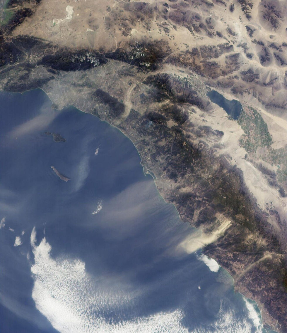
Santa Ana winds streaming offshore from Southern California out over the Pacific, captured from orbit. Photo by NASA/JPL-Caltech, via Wikimedia Commons (Public Domain).
What Exactly Is a Santa Ana Wind?
A Santa Ana is a strong, dry, offshore wind that blows from the interior deserts and high country of the Great Basin toward the Southern California coast - the opposite of the gentle onshore sea breeze that dominates most of the year. Instead of cool, moist air drifting in off the ocean, you get warm, parched air rushing out toward it, often gusting hard through the canyons and passes that funnel it toward the sea.
The name is distinctly Californian, usually traced to the Santa Ana Canyon in Orange County, where the wind blows through with particular force. The same weather pattern goes by other names up and down the coast. In the Santa Barbara area, divers and sailors talk about sundowner winds that pour down off the mountains in the evening; farther north, similar offshore, downslope winds appear under their own local names. Whatever you call it, the ingredients are the same: high pressure inland, lower pressure at the coast, and a downhill path for the air to follow.
Why Santa Anas Form: The Pressure-Gradient Engine
Santa Anas are driven by a simple but powerful imbalance. In fall and winter, a strong dome of high pressure often parks over the Great Basin - the high desert region covering Nevada, Utah, and the inland corners of neighboring states. Air always wants to flow from high pressure toward low pressure, and when a low sits off the California coast at the same time, you get a steep pressure gradient pointed straight at the ocean.
That gradient forces a river of air downhill, from the elevated interior toward sea level. As the air sinks, two things happen that make a Santa Ana so distinctive. First, it gets compressed. Air squeezed into the denser, lower atmosphere heats up through a process called adiabatic compression - roughly five degrees Fahrenheit of warming for every thousand feet of descent. Air that started out cold in the high desert can arrive at the coast genuinely hot. Second, it gets drier. As the air warms, its relative humidity plummets, sometimes into the single digits. That is why a Santa Ana feels like opening an oven door: hot, dry, and aggressive.
The terrain does the rest. Southern California's mountains and canyons act like nozzles, squeezing the broad inland flow into narrow, accelerating jets. That is why the wind can be calm in one neighborhood and roaring through a canyon mouth a mile away, and why coastal spots downwind of a major pass often get hammered while a sheltered cove next door stays glassy. Local geography decides who gets the full force of the wind and who gets the clean, protected water in its lee.
When Santa Anas Blow
Santa Ana season runs roughly from September or October through February, with the strongest and most frequent events in late fall and early winter. They can show up in a weaker form into spring. They are fundamentally a cool-season pattern, because that is when the Great Basin high and the offshore low reliably set up together. In the heart of summer, the dominant onshore sea breeze usually wins, and true Santa Anas are rare.
For divers, that seasonality matters. The Santa Ana dive window overlaps with some of the year's better Southern California visibility for reasons beyond the wind itself - cooler water, fewer heavy plankton blooms in some areas, and calmer stretches between winter storms. A well-timed Santa Ana stacked on top of those conditions can produce a genuinely exceptional day, the kind divers talk about for months.
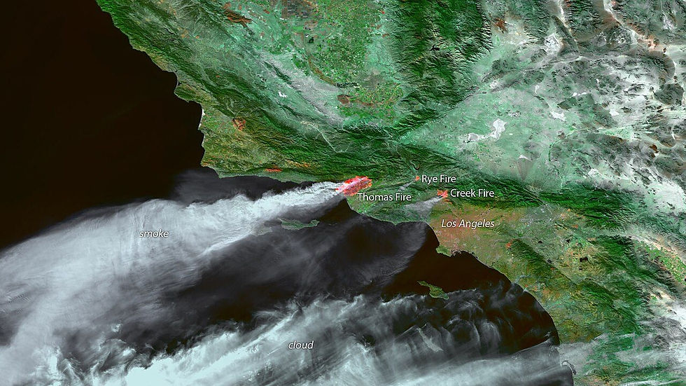
Santa Ana winds push smoke and dry desert air offshore over Southern California during a December wind event. Image by NOAA/NESDIS, via Wikimedia Commons (Public Domain).
Why Divers Watch the Fire Weather
There is a grim reason Santa Anas are household words in California: they are the engine behind the state's worst wildfire days. The same hot, dry, fast-moving air that flattens the ocean also turns brush into tinder and drives flames across ridgelines faster than crews can respond. Many of the largest, most destructive fires in Southern California history have been Santa Ana driven.
For a diver, that connection is a useful forecasting shortcut. When the news is full of red flag warnings, offshore wind advisories, and fire weather alerts, that is precisely the pattern that can be laying down the swell and clearing the nearshore water at the coast. The wind that fire crews dread is often the wind that sets up the dive. It is worth saying plainly: a Santa Ana is a serious land hazard, and conditions on the water can be hazardous too. The point is not that Santa Anas are good news - it is that the same system has very different effects on the hills than it does on the sea surface.
Onshore vs. Offshore Wind
Every coastal wind falls into one of two camps, and the difference is everything for visibility. Onshore wind blows from the ocean toward the land. Offshore wind - the Santa Ana - blows from the land toward the ocean. They do almost opposite things to the water you are trying to dive.
Onshore wind pushes surface water toward the beach, piling up chop, stirring the shallows, and stacking floating debris and murk right where you swim in.
Offshore wind does the reverse, sliding the top layer of water away from the beach and out to sea, often dragging surface murk with it and letting cleaner water fill in near shore.
Onshore wind builds local wind chop quickly because it has the whole ocean as fetch; offshore wind has to fight the land, so the nearshore surface often stays glassy even when it is honking up on the bluff.
Offshore wind grooms and flattens incoming swell faces, knocking the tops off waves - the same effect surfers prize on a clean offshore morning.
How a Santa Ana Cleans the Water
Put those effects together and you can see why the morning after a Santa Ana is so prized. The offshore flow does several helpful things at once. It grooms and flattens the surface, holding back the wind chop that normally cuts visibility from the top down. It knocks the energy out of incoming swell, so the waves that do arrive break cleaner and stir up less sand. And critically, it slides the surface layer of water - the part most loaded with suspended particulate, plankton, and runoff murk - away from the beach, letting clearer water move up near shore.
The result, on a good day, is glassy, flat water with the kind of clarity Southern California divers chase all year. The effect is strongest in the first calm hours after a wind event eases, when the surface has been groomed but the water has settled. This is the classic morning-after window: get on the water early, before the daytime sea breeze rebuilds and undoes the work overnight.
It is not automatic. A Santa Ana cannot fix water that is fouled by a heavy plankton bloom, and it cannot undo the sediment a recent big swell or rain event has already suspended throughout the column. But layered on top of otherwise decent conditions, an offshore wind event is one of the most reliable visibility boosters on the California coast.
Wind Is Not Swell
One of the most common mistakes newer divers make is treating wind and swell as the same thing. They are not. Swell is the long-traveled energy of distant storms, organized into sets that arrive at the coast regardless of the local wind. Wind is the immediate, local push of air on the water surface, and it creates its own short, choppy, disorganized waves on top of whatever swell is running.
You can have a flat, glassy, windless morning with a big, powerful groundswell wrapping into a point - clean water, but heavy surge and large breaking waves. You can also have a small swell paired with a screaming onshore wind that turns the surface into a washing machine. A Santa Ana attacks the wind half of that equation: it can groom away local chop and flatten swell faces, but it does not erase the underlying groundswell. Always read swell height, period, and direction separately from wind. The dive-conditions tool treats them as distinct inputs for exactly this reason.
The Hidden Danger of Offshore Wind
The same wind that makes the water beautiful can also be deadly, and every California diver needs to respect it. Offshore wind blows away from the beach and toward the open ocean. Anything floating - a kayak, a dive float, a paddleboard, a tired diver resting on the surface - gets pushed steadily out to sea, often without the person noticing until the beach looks alarmingly far away.
Offshore wind also tends to flatten the nearshore surface in a way that hides its own strength. Because it is blowing away from you and grooming the chop, the water near the beach can look deceptively calm and inviting, even as a strong, persistent force works to carry you out. People require rescue - or worse - in exactly these conditions every year, frequently on the prettiest-looking days.
Never dive a strong offshore wind day from a small craft, float, or board without a clear plan to get back upwind, and assume you will be slower returning than leaving.
Watch your position against fixed landmarks constantly; offshore drift is gradual and easy to miss until it is a problem.
Stay closer to shore than you normally would, and turn the dive earlier - the wind tends to build through the morning, not ease.
Carry signaling gear and tell someone on land your plan; a diver pushed offshore and out of sight is a serious emergency.
Reading the Forecast Like a Diver
You do not need to be a meteorologist to spot a Santa Ana setting up. The tells are consistent: forecasts calling for hot, dry, gusty conditions inland; red flag or fire weather warnings; relative humidity dropping into the teens or single digits; and wind direction shifting to come from the north and east instead of the usual west and southwest. When you see that combination in the cool season, the coast may be about to get a clean-up.
The smart play is to pair the wind picture with the rest of the conditions. Check that swell is manageable, that there has not been recent heavy rain to dump runoff, and that no major bloom is fouling the water. When the offshore wind lines up with otherwise clean inputs, target the first calm hours after the peak of the wind, dive close to shore, and keep a hard eye on your drift. That is the recipe for cashing in on a Santa Ana without getting bitten by it.
Putting It Together
Santa Ana winds sit at the strange intersection of hazard and opportunity. On land, they are among the most dangerous weather California sees. On the water, handled with respect, they can deliver the flattest, cleanest diving of the year. The difference comes down to reading them correctly: knowing why they form, when to expect them, how they groom the surface and slide the murk offshore, and never forgetting that the same flow can carry you out to sea.
Learn to tell onshore from offshore wind, keep wind and swell separate in your head, and treat every offshore wind day with a mix of excitement and caution. Do that, and the wind that everyone else dreads becomes one of the best tools in your kit for finding clean water on the California coast.
Photos: Santa Ana winds satellite image by NASA/JPL-Caltech; Santa Ana wind event by NOAA/NESDIS. Both via Wikimedia Commons (Public Domain).


Comments