


Spearfishing the San Luis Obispo Coast: Morro Bay, Cayucos, and Central California's Forgotten Reefs

The San Luis Obispo County coast is one of California's quietest diving frontiers. Tucked between the wild remoteness of Big Sur to the north and the busy kelp reefs of Santa Barbara to the south, the SLO coast gets a fraction of the diving pressure of the well-known spots, yet it holds productive reefs, healthy bottom fish, and miles of rarely-touched structure. The trade-off is wind and cold water. If you can work around those, the central coast offers diving that feels genuinely uncrowded.

The Region, North to South
Below the San Simeon and Cambria area in the north, the coast eases into the gentler beaches and reefs around Cayucos. Morro Bay, anchored by the unmistakable Morro Rock, is the practical hub - a working harbor with boat access and protected water inside the bay. South of town, the coastline rises into the rugged headlands of Montana de Oro State Park and continues to Point Buchon, a dramatic stretch of reef and bluff. Farther south, Avila Beach and Port San Luis sit in the wind shadow of Point San Luis, often the most protected diving in the county, before the coast runs down toward Pismo and the dunes.
A Closer Look, Spot by Spot
Here is a closer, north-to-south run through the spots worth knowing — what the bottom looks like, how you get in, and what to watch for at each.
San Simeon and Cambria

The far northern end of the county is the most remote and the most serious. Kelp-lined coves and rocky reef hold good lingcod and rockfish, and San Simeon Cove, tucked behind the pier at William Randolph Hearst Memorial Beach, offers a rare pocket of protected, easy-entry water when the swell is up. The catch is what shares the water with you: the Piedras Blancas elephant seal rookery sits just to the north, and this is the sharpest end of white-shark country on the central coast (see the hazards section below). Dive it with a buddy, keep your catch on a float line, and don't get complacent.
Cayucos
Cayucos is the friendliest entry point in the county. The beach itself is sand — good for a mellow halibut hunt in the warmer months — and the reef and rock structure builds to the north toward the bluffs, holding rockfish and the occasional lingcod. Easy parking, a pier, and gentle beach entries make it the natural place to get a feel for the central coast before you commit to the rougher rock elsewhere. Estero Bay is still exposed, so it blows out in the afternoon wind like everything up here; treat it as an early-morning dive.
Morro Bay and Morro Rock
Morro Bay is the practical hub of SLO diving. The working harbor has the county's only real boat ramp, and a boat is the key that unlocks the whole Estero Bay reef system and the offshore structure you simply can't reach from the beach. Around the harbor mouth and Morro Rock you get more protected — if current-swept — water, but the estuary itself is an eelgrass nursery with take restrictions, so this is a spot where you absolutely confirm the MPA lines before you put a fish on the stringer. The harbor mouth runs hard current on the tide; time it, or stay outside of it.
Montaña de Oro and Hazard Reef

South of Los Osos the coast turns wild at Montaña de Oro State Park. Spooner's Cove is the main beach — sand-bottomed and the gentlest way in — while Corallina Cove to the south is a tidepool-rich pocket of reef. The prize is Hazard Reef (Hazard Canyon Reef), a big, ledgy expanse of rock a couple of miles down the coast from the main lot. It is thick with structure that holds lingcod, vermilion, and a full spread of rockfish, and it was historically a prized abalone reef. The trade-off is access: the trail is long, the terrain is rough, and the entry is over slick boulders straight into open swell. It rewards fit, experienced divers and punishes casual ones.
Point Buchon and the Pinnacles
Point Buchon is the most dramatic reef in the county — a series of large pinnacles dropping from around 25 feet down past 100, wrapped in bull kelp and loaded with invertebrates and fish. It is outstanding hunting and photography water. The complication is regulation: the Point Buchon State Marine Reserve offshore the point is fully no-take, and the adjacent Marine Conservation Area carries its own limits. The best pinnacles sit right up against protected water, so you have to know exactly where the lines fall. Land access runs through PG&E's gated Point Buchon Trail, which is why most people fish it from a boat out of Morro Bay.
Diablo Canyon and the Warm-Water Anomaly
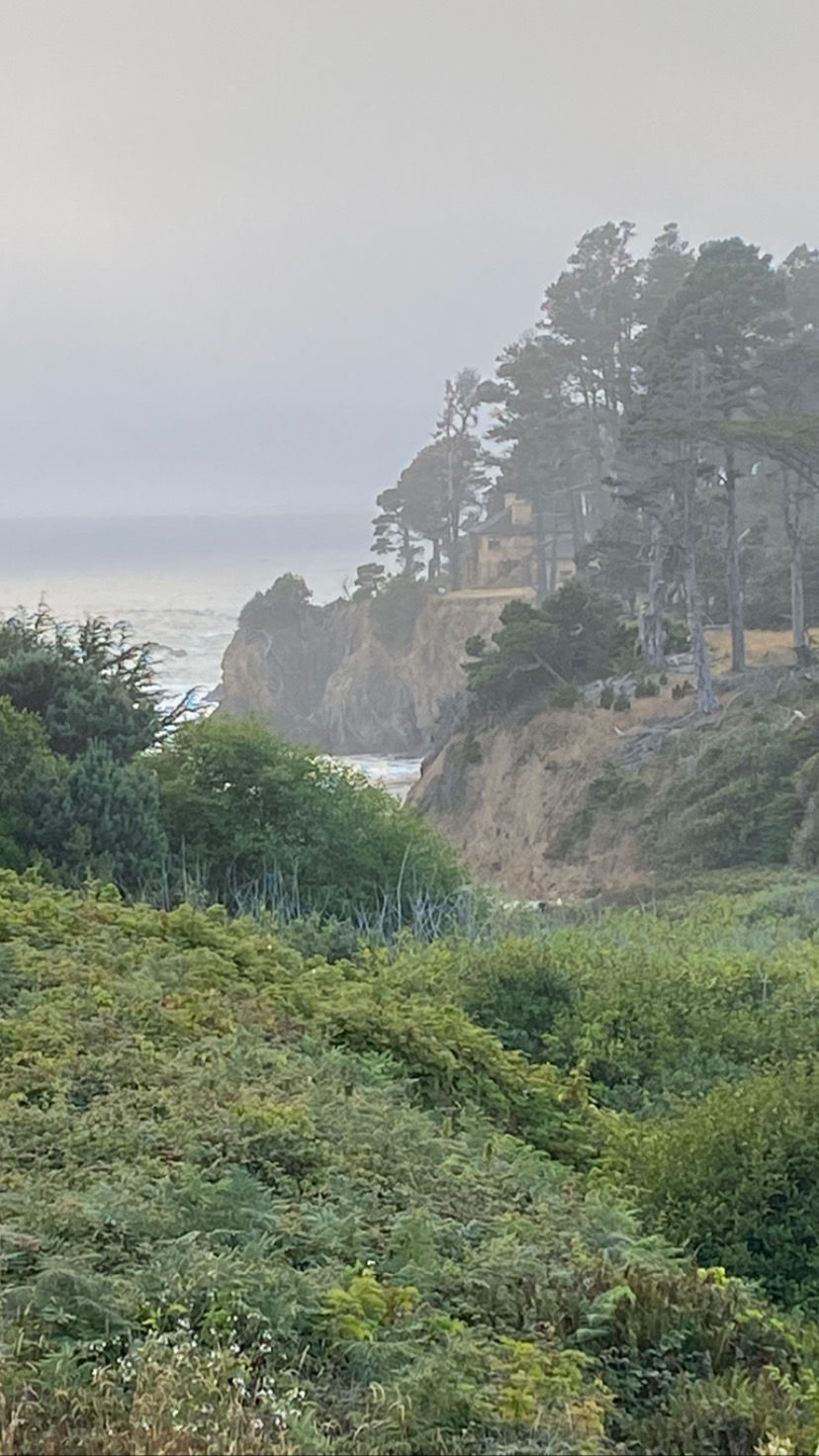
Just south of Point Buchon sits one of the strangest pieces of ecology on the California coast. The Diablo Canyon Power Plant pulls in and discharges roughly 2.5 billion gallons of seawater a day to cool its reactors, and it returns that water warm — around 75°F, far above the low-50s that define the rest of this coast. Decades of that thermal plume have nudged Diablo Cove toward a Southern California-style ecosystem, with warm-water species, kelp, and a marine community that looks genuinely out of place this far north. It is a unique little pocket of the ocean. The honest caveat: you cannot dive it. Diablo Cove and the water immediately around the plant sit inside a strict security exclusion zone that is off limits. But that warm outflow still bleeds into the surrounding water, and it is part of why this stretch of coast can fish a little differently than the reefs just up the road.
Avila Beach and Port San Luis

If the rest of the county is blown out, Avila is where you go. Point San Luis juts out and throws a real wind shadow over Avila Beach and Port San Luis, making this the most protected — and most reliably diveable — water in SLO County. Kelp reef, the piers, and easy beach and pier access make it forgiving, and it holds halibut on the sand and rockfish on the rock. It is the classic fallback: when the northwest wind fills in early and the open coast turns to chop, Avila often still has a workable window.
Pismo and the Southern Beaches
South of Avila the coast flattens into the long sand beaches and dunes of Pismo. There is little hard reef here — it is sand-bottom country, historically famous for its clams — so it is mainly a halibut-on-the-flats proposition in the warm months rather than a rockfish reef dive. It is the gentlest, most exposed, and least structured end of the county.
What You Will Hunt
The SLO coast is bottom-fish country, much like Monterey. Lingcod and cabezon hold on the rocky reefs and rate as the prize central-coast targets. A broad mix of rockfish covers the reef from shallow to deep. The sand flats and channel mouths around Morro Bay and the open beaches hold California halibut, especially in the warmer months. In warm-water years, white seabass and even yellowtail can push up this far, particularly around the more southern, kelp-lined reefs, but they are a bonus rather than the bread and butter.

Lingcod are the bread and butter of the SLO coast’s rocky reefs — ambush predators that hold tight to structure in the cold, green water.
Wind Is the Defining Factor
More than almost anywhere else in California, the SLO coast is governed by wind. The region sits north of Point Conception in the path of the powerful spring and summer northwest wind that funnels down the coast. On a typical day the morning starts manageable and the wind builds hard through the afternoon, blowing the surface to chop and ending the dive. The successful central-coast diver is an early riser: get in at first light, get your dive, and be out before the wind fills in. Spring is often the windiest, frustrating stretch; fall frequently brings the calmest, clearest windows of the year.
Cold Water and Visibility
Expect cold, upwelling-driven water and the same green-summer tendency that defines the central coast - calm summer days do not guarantee clear water here. A 7mm suit with hood and gloves is standard, and a drysuit is a reasonable choice for regulars. The clearer water often arrives in the fall, when upwelling eases and the swell is between storm seasons. Tuck in behind a point or into the wind shadow at Avila on a windy day and you can sometimes find diveable water when the open coast is blown out.
Marine Protected Areas and Access
The SLO coast carries its own set of marine protected areas, including protected water around the Point Buchon area and restrictions in and around Morro Bay, plus the long-standing exclusion zone around the Diablo Canyon facility that keeps a chunk of otherwise prime coast off limits. Boundaries are specific and consequential. Morro Bay harbor offers the most straightforward boat access in the county, while Cayucos, Montana de Oro, and Avila provide beach and cove entries. As always, confirm the current CDFW marine protected area boundaries and any access restrictions for your exact spot before diving.
Hazards to Respect
The SLO coast rewards divers who respect it, but it is a wilder, less-forgiving stretch than the crowded reefs down south. Help is farther away, the water is colder, and a handful of specific hazards deserve real planning before you ever get in.
White Sharks and the Elephant Seal Rookeries
This is white shark country. The northern SLO coast sits at the southern edge of the “Red Triangle,” and the enormous elephant seal rookery at Piedras Blancas, just north of San Simeon, concentrates exactly the prey that draws large white sharks close to shore. Dive with a buddy, keep your catch on a float line well away from your body rather than strung to your belt, and think twice before diving alone near the seal colonies or in low visibility. Encounters are rare, but this is the wrong coast to be complacent about them.

The northern SLO coast sits at the southern edge of the Red Triangle — white sharks patrol these waters year-round. Photo: Bernard Dupont, CC BY-SA 2.0.

The Piedras Blancas elephant seal rookery north of San Simeon is a major draw for white sharks — a good stretch of coast to think twice about. Photo: Mike Baird, CC BY 2.0.
The Rocky Shoreline and Surge
Most of the good diving here is off rocky points and reef, not sandy beach, which means your entry and exit are over slick, uneven boulders with waves pushing through. Surge near the rocks can slam you into structure or turn a routine exit into a scramble. Scout your exit before you swim out, time your movements with the sets, wear sturdy boots, and never turn your back on the ocean while you are climbing out.

Big NW swell breaking on a rocky headland. Most SLO diving is off rock, not sand, so surge and a well-timed exit are part of the deal.
Swell, Wind, and Remote Access
The same NW wind and swell that govern visibility here also make conditions change fast, and much of this coast is genuinely remote — long drives, spotty cell service, and no lifeguard or quick rescue at many spots. Check the marine forecast, tell someone your plan, carry a way to signal for help, and be honest about whether you can self-rescue if the wind comes up while you are a quarter mile offshore.
Cold Water
Upwelling keeps this water cold nearly year-round, often in the low-to-mid 50s. A proper 7mm suit, hood, gloves, and boots are not optional, and long surface swims in cold water drain you faster than you expect. Dress for the temperature at depth, not for the sun on the drive in.
Diving the SLO Coast Smart
Treat wind as your number-one planning factor; dive at dawn and be out before the afternoon northwest wind builds.
Use the wind shadows - Avila and Port San Luis often stay diveable when the open coast is blown out.
Target fall for the calmest, clearest windows; expect green summer water despite calm days.
Dress for genuinely cold water and keep sessions tight.
Confirm marine protected area boundaries and the Diablo exclusion zone before you choose a spot.
The San Luis Obispo coast will not hand you easy blue water, but for divers willing to chase the calm windows and rise before the wind, it offers something increasingly rare in California: productive, uncrowded reef where you can have a stretch of coast largely to yourself.


Comments